
Where's the fanfare for Route 64?
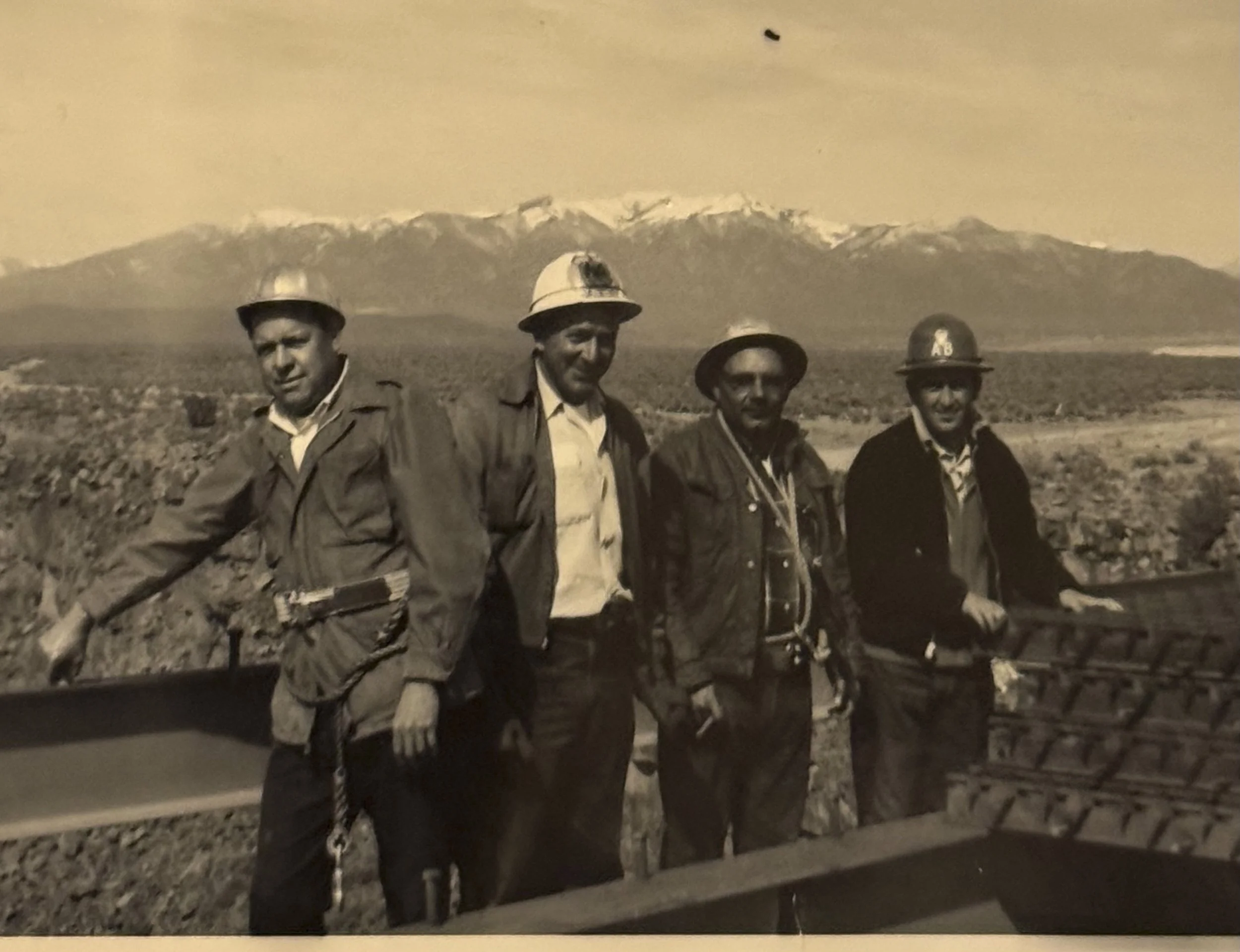
In this photo, dated March 1965, workers stand on exposed steel girders of the nearly completed Rio Grande Gorge Bridge which spanned the deep canyon nearly 600-feet above the waters of the Rio Grande. This addition to U.S. Route 64 made passage from Taos to Tres Piedras much safer and more reliable than the previous crossing at the Taos Junction Bridge.
By Arcenio J. Trujillo
October, 2026
MainStreet Beat - Taos News
Here it is with the weird PDF-style line breaks removed, while keeping the original paragraphs and wording:
If someone was looking to get their “kicks,” where should they go? Assuming one was looking for the frills and thrills of a long road trip, there once was a particular highway that could, theoretically, facilitate this request.
This was the emphasis of Nat King Cole’s adventure song and its main chorus which was first published in 1946, and enchanted a bevy of automobile travelers who subsequently converged on the cross-country roadway known as Route 66 – in search of said “kicks.”
And with the 100-year anniversary of the famed highway taking place this year, you’ll probably hear that song played plenty of times in conjunction with Route 66 television shows, documentaries and tributes as a stroll down memory lane is taken – especially with regards to the various towns along the historic corridor here in New Mexico.
Route 66, or U.S. Highway 66 was commissioned on November 11, 1926. The official starting point of the 2,448-mile scenic byway was in the heart of downtown Chicago, Illinois and ended at the Pacific Ocean in Santa Monica California. The well-known, east-to-west alignment through our state flowed through larger-sized towns such as Tucumcari, Santa Rosa, Moriarty, Tijeras, Albuquerque, Grants and Gallup (the original alignment included a northwest spur which skirted Las Vegas and coursed through Pecos, Santa Fe and Los Lunas before rejoining the main path east of Laguna Pueblo). The highway was affectionately known as the “Mother Road.”
Also celebrating a 100-year birthday is our very own cross-country roadway, U.S. Route 64 – which comes right into the heart of our town – and possesses similar traits and lore of other well-known traverses like the “Mother Road,” “Pacific Coast Highway,” “Lincoln Highway” or “Dixie Highway.” And though there is no clever nickname or snappy song associated with U.S. 64, there are some important similarities that should be noted with this particular route and equally scenic byway – which stretches 2,281-miles from Nags Head, North Carolina to Teec Nos Pos, Arizona (just west of the New Mexico and Arizona border near the Four Corners). U.S. 64 was launched on the exact same day as Route 66, and was part of a nationwide system implemented to number highways and byways in a coordinated fashion.
In New Mexico (traveling east to west), U.S. 64 passes through Clayton, Des Moines, Raton, Cimarron, Eagle Nest, Angel Fire, Taos, Tierra Amarilla, Chama, Dulce, Bloomfield, Farmington and Shiprock. The route itself has changed greatly throughout the decades due to the challenging terrain the road had to circumvent. Unlike the more famous Route 66, the northern route had to surmount two mountain ranges (Sangre de Cristo and San Juan) on the southern flank of the Rocky Mountains; and get across the Rio Grande gorge and its unpredictable river. Before the span of the Rio Grande Gorge Bridge officially opened on September 10, 1965, vehicles of all types had to descend into the canyon via the old dirt road along the Pueblo River that led to the Taos Junction Bridge; climb the western ascent; and head to Tres Piedras on a much more primitive Rim Road.
Since the mid-1900’s, U.S. 64 has undergone other transformations that have affected visitors and locals from our Northern New Mexico region. This included the safety features and modernization of the segment that crosses the Tusas Mountains west of Taos County; which accords access to Carson National Forest, Hopewell Lake, Brazos Mountain overlook and points west. Closer to home, and very recently, U.S. 64 was improved as part of the multi-year road construction that took place through downtown Taos.
Knowing that one of the main arteries in and out of our state and Taos is also turning 100 this year, it would be fitting if there was a regional celebration or a bit of fanfare to highlight this achievement. It would be suitable if Route 64 had a jingle of its own, or had a catchy nickname to put on a sign indicating its historic relevance.
In any case, if you walk along the main street north of the plaza intersection known as Paseo del Pueblo Norte; drive on the narrow and winding two-lane road emerging from Taos Canyon from the east, or if you take the straightaway toward the gorge bridge to the west, know that you are on a notable stretch of throughfare that has been around for a century.
U.S. 64 is an active, fully designated and maintained highway that still exists and still bears its shield. At the very least, there should be a formal mention for Route 64’s very own centennial milestone.
own centennial milestone.Arcenio J. Trujillo is community engagement coordinator of Taos MainStreet, a 501(c)(3) nonprofit organization dedicated to the economic vitality and historic preservation of downtown Taos. Contact Trujillo at community@taosmainstreet.org. Learn more at taosmainstreet.org.